FAQs
General
Why are we updating the ESA Management Strategy?
We’re proposing an update to our Environmentally Sensitive Areas (ESA) Management Strategy so we’re better equipped to protect the natural areas that are so vital to the well-being of our community.
This Strategy was adopted by Council 20 years ago and it’s time for an update. Development of the initial strategy involved mapping and creating an inventory of watercourses, wetlands, forests, and marine areas. Mapping technology has improved tremendously in recent years and so has our knowledge of how to protect, restore, and connect our natural areas during the development process.
We must also ensure that all development in Port Moody adheres to current federal, provincial, and municipal regulations such as the federal Fisheries Act, provincial Riparian Areas Protection Regulation, and Port Moody’s Zoning Bylaw.
Port Moody has been a leader in the protection of ESAs and this Strategy is one of many tools – such as the Sustainability Report Card, Affordable Housing Policy, and Heritage Strategy – that guide balanced decision-making to protect our community assets.
What is a development permit area (DPA) and why do we need one for environmentally sensitive areas?
A DPA is an area where specific measures may be required to address special conditions or meet established objectives when development activity is proposed. In the case of Port Moody’s environmental DPA, specific measures may be required to protect the natural environment and meet provincial and federal government requirements and regulations. For other DPAs, specific measures may be required for other purposes such as protecting development from hazards or meeting established goals for the form and character of buildings.
An environmental DPA is a flexible tool that allows the City to evaluate specific conditions and activities, and work with property owners to reduce the impact of development on our natural areas and restore habitat where possible.
What is included in the proposed permit area?
Table 1 – Comparison of existing permit area and proposed permit area shows what’s included within the boundaries of the existing permit area (known as DPA 4 in the Official Community Plan) and the proposed permit area (to be called the Environmental Development Permit Area or EDPA).
Why are assessment areas included in the proposed permit area?
We’re proposing the addition of assessment areas in recognition of the ecological value and sensitivity of our forests and the marine shoreline. This change would bring these areas in line with other parts of the city where development activities are already reviewed to determine if environmental development permits are required.
Adding assessment areas to the proposed permit area means that the potential impact of development activity on nearby natural areas can be considered. Working with the property owner, we can gather more information about the landscape and environment, identify where approvals or notifications may be required (federal, provincial, local), and provide guidance on how to modify development plans if necessary to protect our natural areas.
Please note the boundaries of the proposed permit area are not Zoning Bylaw setbacks.
Streamside Setbacks
What is a setback?
A setback is the required minimum distance between a building, structure, or other use of land and an established boundary, such as a lot (land registered as a separate parcel in the Land Title Office) boundary or a stream (measured from top of bank). Streamside setbacks are specified in the Zoning Bylaw (Section 5.4 Streamside Protection); they were determined based on the size and condition of specific watercourses and watersheds.
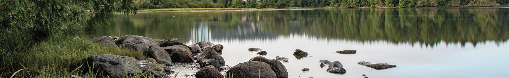
Streamside setbacks are intended to protect riparian areas. Our riparian areas link water to land; they’re vital for maintaining stream health, stabilizing stream banks, and providing fish habitat. They also provide important community benefits such as flood protection and stormwater management.
Are you proposing changes to streamside setbacks?
No, streamside setbacks as specified in the Zoning Bylaw are not changing as part of this proposed ESA Management Strategy update.
How long has the City had streamside setbacks in its Zoning Bylaw?
The federal Fisheries Act and the provincial Riparian Areas Protection Regulation require local governments to protect streamside areas for fish habitat during the development process. Streamside setbacks have been protected through Port Moody’s Zoning Bylaw since 1988. Updates to these setbacks were made in 2006 and 2018 to ensure the City continues to meet or exceed senior government requirements.
In areas that are already developed, some buildings or structures are within streamside setbacks. In these scenarios, staff work closely with the property owner to vary the setback, where appropriate, while still improving environmental conditions.
Why did the City update its mapping?
Currently available City mapping does not reflect existing conditions. Mapping technology has improved tremendously since 2001, when the first phase of the ESA Management Strategy was adopted by Council. The improved mapping that’s part of this Strategy update shows streamside setbacks accurately on City maps for the first time.
Why is the proposed ESA Management Strategy update adding more watercourses?
Improved imaging and software allows more accurate mapping of wetlands and watercourses that in some cases were previously unmapped. While they were not always known to be present, these unmapped watercourses have always been protected by Zoning Bylaw streamside setbacks and are part of the current development permit area.
Accurate mapping of watercourses helps ensure information is available early on in the development application process so that property owners can avoid surprises. Please note some watercourses may still be unmapped and might be identified during the development process.
Why are ditches included as an environmentally sensitive area?
Ditches can provide or contribute to fish habitat, and also require protection under senior government legislation. If the City were to approve development that negatively affected fish and fish habitat, it would be contravening senior government legislation. To address this, ditches have Zoning Bylaw streamside setbacks and are mapped and included as ESAs.
Ditches also provide important stormwater services by allowing water to filter into the soil and improving water quality. Many municipalities are looking for opportunities to re-create ditches or add similar features into their stormwater management networks. There are various types of ditches in Port Moody. By including ditches as ESAs and in the proposed development permit area, more information is gathered through the development process to determine appropriate action.
Marine Shoreline
- a survey may be required to identify existing conditions, including trees, vegetation, habitat, and shoreline protection structures within the proposed permit area and adjacent marine foreshore;
- City staff and the proponent will work together to discuss appropriate protection and mitigation measures, including restoration opportunities if appropriate;
- an environmental assessment of the site may be required if significant changes to the shoreline are proposed; and
- a minor development permit would be needed in most cases – this is already the case for most single-family home projects in other parts of the city that are located within the current permit area.
- locate development footprints as far away as possible from the marine shoreline and minimize footprint size;
- site new development to avoid requirements for additional or new shoreline erosion protection works – new development should not be any closer to the shoreline than existing permanent structures;
- retain, protect, and enhance all natural shoreline vegetation and woody debris, including trees;
- provide a restoration plan for any disturbed or degraded areas of the shoreline – use plants that align with the City's Naturescape Policy;
- prevent the release of sediment and other pollutants – implement an erosion and sediment control plan; and
- contact the Vancouver Fraser Port Authority where applicable for structures or work below the high water mark.
Why is the marine shoreline included in the proposed permit area?
We are proposing a marine assessment area within the permit area in recognition of the ecological value and sensitivity of the marine shoreline. Marine habitats can be greatly affected by land development activities that occur upland of the marine high water mark; this change would bring this area in line with other parts of the city where development activities are already reviewed to determine if environmental permits are required.
This 30-metre area upland from the marine high water mark also aligns with Port Moody’s Official Community Plan, which directs the City to explore policy and planning alternatives that ensure upland development protects and enhances the marine environment of Burrard Inlet.
Port Moody’s shoreline covers a large area, but only one-third of that area is currently protected from development. Healthy shorelines can filter pollutants and improve water quality, support biodiversity, dissipate wave energy, protect property, and reduce risk from sea level rise. The City and community have been working hard for a number of years to protect and maintain significant marine and shoreline habitat within Shoreline and Tidal parks, and the proposed assessment area would support these efforts.
What does the 30-metre line for the assessment area mean?
The marine assessment area extends 30 metres upland from the high water mark; this area is included in the proposed permit area. An assessment area is a portion of land where the potential impact of development on nearby natural areas would need to be considered. This means a property owner who wishes to develop or redevelop their land may require a permit before development activities can begin. An assessment area is not a Zoning Bylaw setback.
The proposed development permit area guidelines do include a 30-metre setback for scenarios involving extensive redevelopment or undeveloped shorelines. In such scenarios, development guidelines would need to be followed to re-establish ecological connections along the marine shoreline and with other protected ESAs, in balance with other community needs. This setback is proposed as a development guideline, not as a Zoning Bylaw setback.
I already have a lease with the Port for areas within the 30 metre assessment area – why do I need additional permits from the City?
In some parts of the City, the Port of Vancouver boundary extends above the existing high water mark. This is a result of historic development patterns and changes in the natural boundary of the sea. If a lot extends into the Port of Vancouver boundary and is covered under other agreements (e.g. Port leases or covenants), development activities may be exempt from the City’s environmental development permit process.
The marine assessment area is intended to identify opportunities for protection and restoration of shoreline habitat through the development process, within areas under the City’s jurisdiction.
Can a single-family home along the marine shoreline be rebuilt if it is within the proposed permit area?
Yes. A development permit area designation is not intended to stop development or prevent re-building of single-family homes; it's a flexible tool that allows the City to evaluate specific conditions and activities, and work with property owners to reduce the impact of development on ESAs and restore habitat where possible.
The purpose of the development permit process is to gather more information about the landscape and environment, identify where approvals or notifications may be required (federal, provincial, local), and to modify development plans if necessary to protect our natural areas.
What guidelines are proposed for single family home redevelopment along the marine shoreline?
We’re proposing a simplified development review process for single-family home construction along already-developed marine shorelines:
Please note that development activities in areas with existing agreements with provincial or federal governments (e.g. Port leases or covenants) may be exempt from the City’s environmental development permit process.
Here are some examples of typical measures:
Why include already-developed residential areas along the marine shoreline in the proposed permit area?
Already developed areas can provide opportunities for small improvements to the marine shoreline and adjacent foreshore habitat. Development guidelines would look for opportunities to protect remaining natural shoreline, protect or restore shoreline vegetation with Naturescape principles, avoid construction that is too close to the high water mark, or incorporate naturalized solutions as part of home rebuilds.
In recognition of constraints for single-family homes along the marine shoreline in particular, a simplified development review process is proposed for single-family home redevelopment. In most cases, it is anticipated that only a minor development permit would be required.
Does the proposed permit area address sea level rise?
The proposed permit area and associated guidelines do not consider sea level rise, but focus on how to protect and restore the shoreline and intertidal habitat during development. However, many of the proposed guidelines have co-benefits that relate to protecting property from sea level rise, such as protecting natural shorelines and using natural measures to protect a property from erosion as opposed to hard infrastructure. A sea level rise study is proposed as an action in the City’s Climate Action Plan.
Development Permit Process
- locating development as far away from the ESA as possible;
- removing invasive plants and planting native vegetation in landscaping;
- restoring degraded areas;
- protecting edge habitat including trees;
- removing encroachments;
- maintaining natural hydrology; and
- green stormwater management.
When is an environmental development permit required?
If your property is in the proposed permit area and you are planning to carry out development as defined in the Official Community Plan, you may need a development permit (DP) or a minor DP. A DP or minor DP is only required if new development activity is proposed in the permit area or if a new home is being constructed.
City staff are available to review proposals at an early stage to determine whether or not a DP or minor DP is required or if the proposed activity can be exempt from the process.
When is an environmental development permit NOT required?
Some common activities that are exempt include the minor repair and maintenance of existing structures, interior renovations, gardening and yard maintenance within an existing landscaped area, habitat and restoration work, and emergency and hazard work. Other exemptions may apply for areas with existing agreements (e.g. covenants, Port lease areas).
What information is needed to apply for an environmental development permit?
A report prepared by a Qualified Environmental Professional (QEP) may be required to assess the potential impact of development on natural areas, determine appropriate protection and enhancement measures, and ensure compliance with all applicable guidelines, bylaws, and provincial and federal government legislation. The contents of the report will depend on the scope and scale of the development and site specific conditions. The smaller the development and the further away it is from the ESA, the less onerous and expensive the QEP report should be.
What conditions are included in an environmental development permit?
Development permit area guidelines stipulate specific measures to protect and restore the ESA. Here are some examples of measures that may need to be taken as part of a development permit:
The measures included in a development permit will depend on the scope, scale, and proximity of development to the ESA.