CANCELLED - Environmentally Sensitive Areas Management Strategy Update
Consultation has concluded
Project update (May 2021)
At their regular meeting on May 11, 2021, Council decided to cancel work on the proposed update to the ESA Management Strategy and asked staff to report back in the future with recommendations for a revised direction and scope of work. We have received valuable input from the community during the engagement process. All feedback collected will be retained and will inform our future work.
City staff and the SFU Centre for Dialogue have prepared the following community feedback reports and shared them with Council:
- Community Feedback Summary from City staff, which summarizes the feedback received since fall 2020 including the most common concerns and topics requiring clarification; and
- What We Heard Report from the SFU Centre for Dialogue, which summarizes comments and discussions from the two online engagement sessions held in early 2021 (a list of questions from these sessions is compiled in this report, with answers from City staff).
It has not been determined when a revised direction and scope will be presented to City Council, or when staff will resume work on an update of the ESA Management Strategy. If work on the update is restarted, all affected property owners will be notified by lettermail and we will share with the community via Engage Port Moody and/or the City’s website.
We thank you for your participation in the public engagement process for this project.
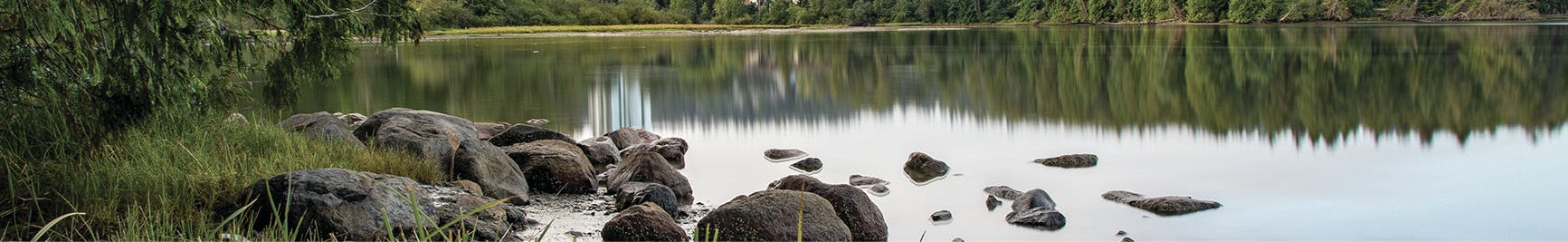
Our Environmentally Sensitive Areas Management Strategy helps us balance urban development with the protection of Port Moody’s natural areas: our forests, streams, wetlands, and marine shoreline.
The Strategy outlines specific things the City and private property owners can do to protect and manage environmentally sensitive areas (ESAs) during the development process. We put this Strategy into practice through the designation of a development permit area (DPA) for environmentally sensitive areas and associated DPA guidelines. For property owners, this means you may need an environmental development permit (DP) if you are planning to develop within the designated area.
Please note that definitions for words in bold blue type can be found in our list of key terms.
This Strategy was adopted by Council 20 years ago and it’s time for an update. Take a look at a historical timeline of the City’s efforts to protect ESAs during the development process.
Development of the initial strategy involved mapping and creating an inventory of watercourses, wetlands, forests, and marine areas. Mapping technology has improved tremendously in recent years and so has our knowledge of how to protect, restore, and connect our natural areas during the development process. We must also ensure that all development in Port Moody adheres to current federal, provincial, and municipal regulations such as the federal Fisheries Act, provincial Riparian Areas Protection Regulation, and Port Moody’s Zoning Bylaw.
What’s changing?
The proposed update includes:
- accurate mapping, including improved mapping of watercourses (including ditches), forest areas and marine high water;
- a revised development permit area, with a name change from “DPA 4: Environmentally Sensitive Areas” to “Environmental Development Permit Area” (EDPA);
- the addition of assessment areas, which are portions of land around ESAs (15 metres around forest ESAs and 30 metres upland from the marine high water mark) where the potential impact of development activities on nearby natural areas would need to be considered and assessed (assessment areas are not setbacks; they are areas where you may need a permit if you are planning to develop); and
- updated DPA guidelines that incorporate best practices for the protection and restoration of ESAs, reduce negative impacts related to nearby urban development, and ensure requirements of senior governments are met.
We are proposing assessment areas in recognition of the ecological value and sensitivity of our forests and the marine shoreline. This change would bring these areas in line with other parts of the city where development activities are already reviewed to determine if environmental permits are required.
To find out how the proposed update would affect the boundaries of the existing development permit area for ESAs, take a look at Map 1 and Table 1. They show what’s included within the boundaries of the existing permit area and the proposed permit area.
Map 1 | Table 1 |
Find out more
Read the full proposed ESA Management Strategy update (66mb) (PDF), view our info sheet titled "How would the proposed changes affect property owners?", take a look at the resources in the right hand column, or ask a question below.
Thank you to everyone who participated in our general information session on January 28, 2021 or our targeted workshop for residents and property owners along the marine shoreline on February 4, 2021.
Thank you for sharing your thoughts with us!
Thank you to everyone who filled out a feedback form by February 21, 2021. City Council will consider a public engagement summary and the proposed ESA Management Strategy update at a council meeting in spring 2021. We'll share the engagement summary on this page.
-
Map 1 – Proposed Environmental Development Permit Area (EDPA)
Share Map 1 – Proposed Environmental Development Permit Area (EDPA) on Facebook Share Map 1 – Proposed Environmental Development Permit Area (EDPA) on Twitter Share Map 1 – Proposed Environmental Development Permit Area (EDPA) on Linkedin Email Map 1 – Proposed Environmental Development Permit Area (EDPA) linkMap 1 below shows the areas included within the boundaries of the proposed Environmental Development Permit Area.
Click on the map to download a PDF (1.3mb).
-
How would the proposed changes affect property owners?
Share How would the proposed changes affect property owners? on Facebook Share How would the proposed changes affect property owners? on Twitter Share How would the proposed changes affect property owners? on Linkedin Email How would the proposed changes affect property owners? linkEnvironmental development permits are already required for specific development activities on land located in and around our protected natural areas, so the proposed update to the ESA Management Strategy will not have a direct impact on the majority of property owners. However, the boundaries of the proposed permit area have been revised to include some additional properties, such as those along the marine shoreline. This change brings these properties in line with others located near natural areas.
If your property is located within the boundaries of the proposed permit area and you plan to develop or redevelop your land, you will need to arrange a review by City staff to determine if your planned activities require a development permit (DP) or a minor DP.
A DP is a permit approved by City Council that identifies specific measures that must be taken as a condition of development. A Minor DP can be approved by City staff and can be used to process applications for the reconstruction of single family homes in or around ESAs.
Not all activities require a permit – some activities, such as interior renovations, minor repairs, and maintenance within existing landscaped areas, are exempt.
It’s important to note that a development permit area designation is not intended to stop development or prevent re-building of single-family homes; it's a flexible tool that allows the City to evaluate specific conditions and activities, and work with property owners to reduce the impact of development on ESAs and restore habitat where possible. The purpose of the development permit process is to gather more information about the landscape and environment, identify where approvals or notifications may be required (federal, provincial, local), and to modify development plans if necessary to protect our natural areas.
Permit requirements will continue to depend on the type, scale, and location of development and existing property conditions. When small, single-family home construction with no direct impact on ESAs is proposed within assessment areas, it is anticipated that a minor DP will be required outlining measures for protecting natural areas. For larger-scale developments, such as multi-family projects, a more detailed assessment would be required to determine specific measures and conditions of development.
Activities that may require a DP or minor DP include:
- demolition
- construction or addition to a building or other structure
- land alteration (e.g. clearing, grading, impervious surfaces, infrastructure, new landscaping)
- subdivision
- rezoning
Exempt activities include:
- activities that comply with existing agreements with senior government agencies or covenant terms
- property works (e.g. interior renovations, maintenance and repair of existing buildings and structures, gardening, maintenance within existing landscaped areas)
- ecological restoration and enhancement works
- emergency and hazard works
- public utilities and operational works
Please see the illustration for examples of measures that may be required under development permits to protect and restore ESAs:


FAQs
-
 General
-
Streamside Setbacks
- What is a setback?
- Are you proposing changes to streamside setbacks?
- How long has the City had streamside setbacks in its Zoning Bylaw?
- Why did the City update its mapping?
- Why is the proposed ESA Management Strategy update adding more watercourses?
- Why are ditches included as an environmentally sensitive area?
-
Marine Shoreline
- Why is the marine shoreline included in the proposed permit area?
- What does the 30-metre line for the assessment area mean?
- I already have a lease with the Port for areas within the 30 metre assessment area – why do I need additional permits from the City?
- Can a single-family home along the marine shoreline be rebuilt if it is within the proposed permit area?
- What guidelines are proposed for single family home redevelopment along the marine shoreline?
- Why include already-developed residential areas along the marine shoreline in the proposed permit area?
- Does the proposed permit area address sea level rise?
-
Development Permit Process
